Editor’s Note: In the storm’s path? Bookmark CNN’s lite site for fast connectivity on low bandwidth.
A vicious storm that smacked the central and eastern US Friday is continuing its assault Saturday with whipping winds and blizzard conditions, rain, snow and dangerous coastal flooding. Meanwhile, a brutal blast of Arctic air is spreading south and east through the central US and will bring snow and ice to the South. Here’s the latest.
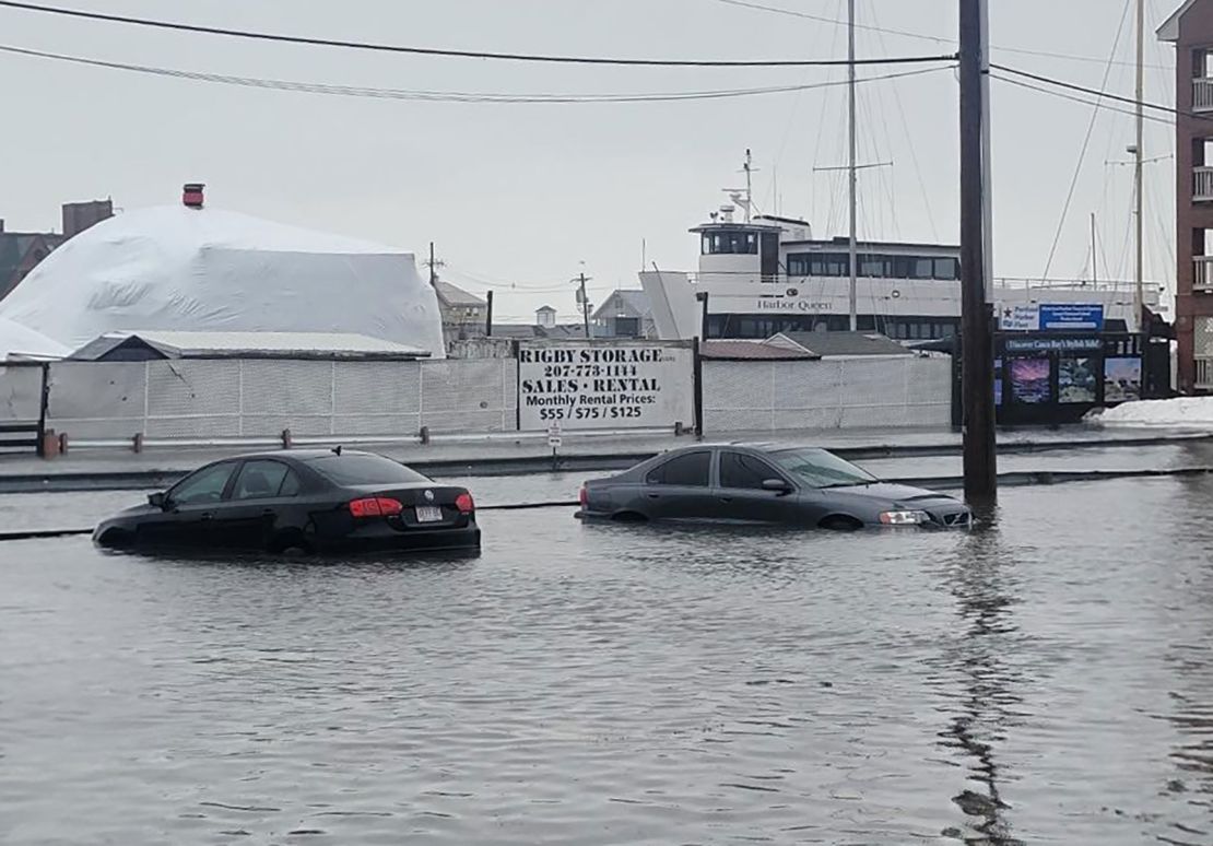
Historic storm surge hits Maine: Water levels on Maine’s coast hit a historic high on Saturday, inundating coastal communities already swamped by record-breaking surges on Wednesday.
Flash flood warnings were issued by the National Weather Service in Gray, Maine, as the storm’s strong winds blew water from the Atlantic Ocean toward the shore on top of high tide Saturday morning and combined with falling rain to create a dangerous situation.
The water level in Portland hit 14.57 feet just after noon, higher than the 13.84 feet hit on Wednesday, and higher than the previous record set in 1978, National Weather Service data shows.

Portland police said on X that there were “too many” roads closed to list because of the flooding. Roads were also closed in coastal New Hampshire as water levels rose there, according to the state’s department of transportation.
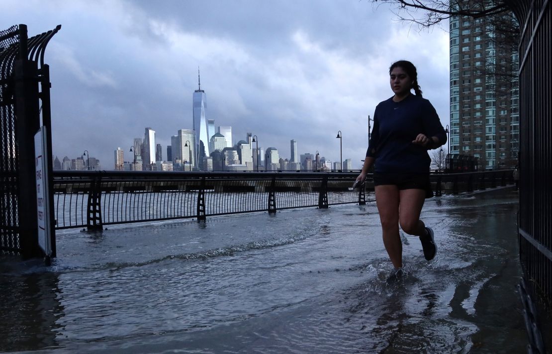
Moderate coastal flooding was also reported in New Jersey, New York, Connecticut, Massachusetts and Rhode Island, NOAA data shows.
Coastal flood alerts remain in effect for several spots throughout the day Saturday for lingering flooding, with most set to expire by the end of the day.
Buffalo Bills playoff game postponed: The scheduled game between the Bills and Pittsburgh Steelers in Buffalo was moved from Sunday at 1 p.m. to Monday at 4:30 p.m. because of the “dangerous conditions,” New York Gov. Kathy Hochul said on X Saturday.

Strong winds from the storm blowing across an exceptionally warm, ice-free Lake Erie will produce heavy lake-effect snow through Monday morning. One to 3 feet of snow could fall, with the highest totals coming where the bands of snow persist the longest.
“Winds gusting as high as 65 mph early in the event will diminish somewhat late Saturday night. Blizzard conditions will be possible at times, especially Saturday night and Sunday,” the weather service in Buffalo said.
In Erie County, New York, which includes Buffalo, officials have declared a state of emergency starting Saturday due to the incoming storm and snow, county executive Mark Poloncarz announced.
A travel ban was also set to go into effect at 9 p.m. ET Saturday for Erie County to help crews clear the roads given the intense snowfall to come.
More than 450,000 homes and businesses in the dark: Widespread power outages stretched from the Great Lakes to the South Saturday after intense winds, severe thunderstorms and heavy snow walloped several states. Strong winds on the back side of the storm caused power outages to climb throughout the morning in the Great Lakes. As of 12 p.m. ET, Michigan had the most utility customers without power – more than 185,000 – followed by more than 90,000 customers cut off in Wisconsin.

Iowa is the epicenter for blizzard conditions and cold: Most of Iowa was under a blizzard warning Saturday as 6 to 10 inches of previous snowfall was whipped up by wind gusts of more than 40 mph. Back-to-back storms hammering the Midwest have resulted in the snowiest week for Des Moines since 1942.
The Iowa State Patrol responded to 535 motorist assist calls and 86 crashes by Saturday afternoon as whiteout conditions pounded the state, the agency said in a social media post.
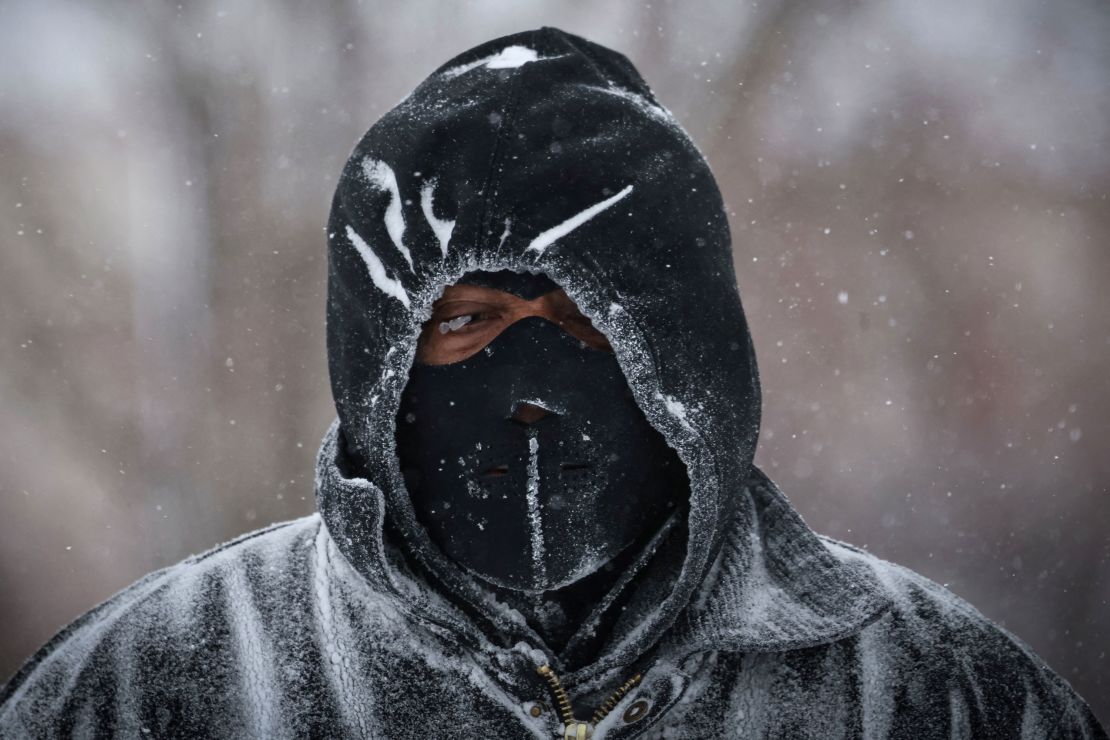
Bone-chilling cold began to envelop the state and is expected to make for the coldest Iowa caucuses on record Monday. Wind chills as low as minus 45 degrees were forecast by Sunday morning, cold enough to cause frostbite on exposed skin in as little as 10 minutes.
In pictures: Winter storms blast central and eastern US
Freezing cold for 75% of the US: It’s not just Iowa, 75% of the country will experience temperatures below freezing over the next 7 days as a potent blast of Arctic air plunges south.
Fifty-five million of them will endure temperatures below zero. The temperatures will feel even colder when coupled with wind. A wind chill of minus 71 degrees was recorded in Navajo, Montana, Saturday morning.
Bitter cold tees up South snow and ice: Temperatures well below average will fully envelop the South and parts of the Southeast by Tuesday.
A new storm system will track through the cold air and start to put out snow, sleet and ice as soon as Sunday afternoon in parts of Oklahoma and Texas.
Any wintry precipitation that falls Sunday will hang around on untreated surfaces because of the cold, making for a potentially treacherous Monday morning commute in places like Dallas.
The system will then leave a shot of modest snow from west to east across Arkansas, northern Louisiana, Mississippi and Alabama and into Tennessee. Points to the south are more likely to see ice than snow.
Arkansas looks set to receive some of the most snow from the event. Six inches or more could fall in parts of the state. Arkansas Gov. Sarah Huckabee Sanders declared a state of emergency Friday ahead of the bitter cold and snow.
Louisiana Gov. Jeff Landry announced a state of emergency in effect from Sunday through Wednesday for the storm and cold as well.
CNN’s Eric Zerkel, Taylor Ward, Mary Gilbert, Allison Chinchar, Holly Yan, Robert Shackelford, Dave Alsup, Joe Sutton, Sara Smart, Zenebou Sylla, Artemis Moshtaghian and Nicole Grether contributed to this report.
U.S. - Latest - Google News
January 14, 2024 at 02:59AM
https://ift.tt/wZgdGQ4
Vicious storm triggers historic coastal flooding as Arctic chill tees up the South’s first snow - CNN
U.S. - Latest - Google News
https://ift.tt/EL5Djfq
Shoes Man Tutorial
Pos News Update
Meme Update
Korean Entertainment News
Japan News Update
Bagikan Berita Ini


0 Response to "Vicious storm triggers historic coastal flooding as Arctic chill tees up the South’s first snow - CNN"
Post a Comment